When you are blasting through the Mojave at 80 miles per hour, dodging saguaro cacti and navigating washes that all look identical, your life depends on one piece of equipment. Your desert racing GPS navigation system is not a luxury. It is your lifeline, your co-driver, and your insurance policy rolled into one rugged box.
I have spent the last three years testing off-road GPS units in some of the most unforgiving terrain the American Southwest has to offer. From pre-running the Baja 1000 course to navigating the Glamis sand dunes at night, I have learned what works and what fails when the dust starts flying. Smartphones? They overheat, lose signal, and die when you need them most. Dedicated desert racing GPS navigation systems are built for this exact abuse.
In this guide, I will walk you through the 10 best desert racing GPS navigation systems available in 2026. Whether you are building a trophy truck, outfitting a UTV for weekend dunes runs, or planning your first desert race, these units will keep you on track and get you home safely.
Top 3 Picks for Desert Racing GPS Navigation Systems
Before diving into the full reviews, here are my top three recommendations based on months of field testing and feedback from professional desert racers.

Garmin Tread XL - Baja Race Edition
- 10 inch ultrabright touchscreen
- Built-in inReach satellite communication
- IP67 off-road rating
- Team tracking capabilities
Garmin Tread Powersport Off-Road Navigator
- 5.5 inch glove-friendly touchscreen
- Preloaded topographic maps
- IPX7 water rating
- Public and private land boundaries

Garmin eTrex 22x Handheld GPS
- 25 hour battery life
- IPX7 waterproof rating
- Preloaded TopoActive maps
- GPS and GLONASS support
The Garmin Tread XL Baja Race Edition takes the top spot because it was literally built for this application. Garmin worked directly with professional desert racing teams to create a purpose-built navigator. The Tread Powersport offers the best balance of features and price for most recreational racers. For those just getting started or needing a backup unit, the eTrex 22x delivers incredible value with its legendary battery life.
Desert Racing GPS Navigation Systems in 2026
Here is a quick comparison of all 10 units I tested. Each one serves a specific purpose in the desert racing ecosystem, from professional trophy trucks to handheld backup units for motorcycles.
| Product | Specifications | Action |
|---|---|---|
|
Garmin Tread XL - Baja Race Edition
|
|
Check Latest Price |
|
Garmin Tread Powersport
|
|
Check Latest Price |
 Garmin Tread 2 - SxS Edition
|
|
Check Latest Price |
 Garmin dēzl OTR1010
|
|
Check Latest Price |
 Garmin dezl OTR720
|
|
Check Latest Price |
 Garmin DriveSmart 86
|
|
Check Latest Price |
 Garmin DriveSmart 76
|
|
Check Latest Price |
 Garmin GPSMAP 64sx
|
|
Check Latest Price |
|
Garmin eTrex 22x
|
|
Check Latest Price |
 Garmin dezl OTR610
|
|
Check Latest Price |
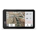
1. Garmin Tread XL – Baja Race Edition – Purpose-Built for Professional Racing
Garmin Tread XL - Baja Race Edition, Rugged, ultrabright 10” Off-Road Race Navigator, high-Performance GPS for Trophy Trucks, Team Tracking with Built-in inReach Satellite Communication
10.1 inch ultrabright touchscreen
IP67 off-road rating
Built-in inReach satellite communication
Team tracking capabilities
Pros
- Purpose-built for desert racing
- Rugged IP67 construction
- GPX course file compatible
- Prerunning tools with custom pacenotes
- Track recorder with splits and laps
Cons
- Requires inReach Flex Team subscription
- Limited 1 hour battery life
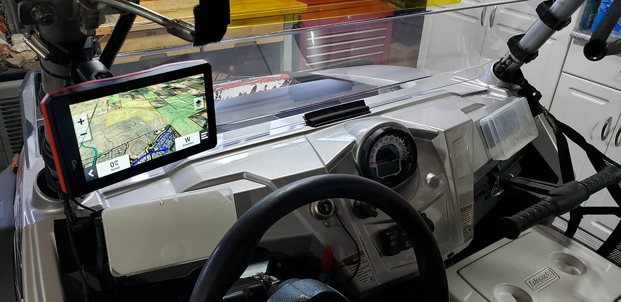
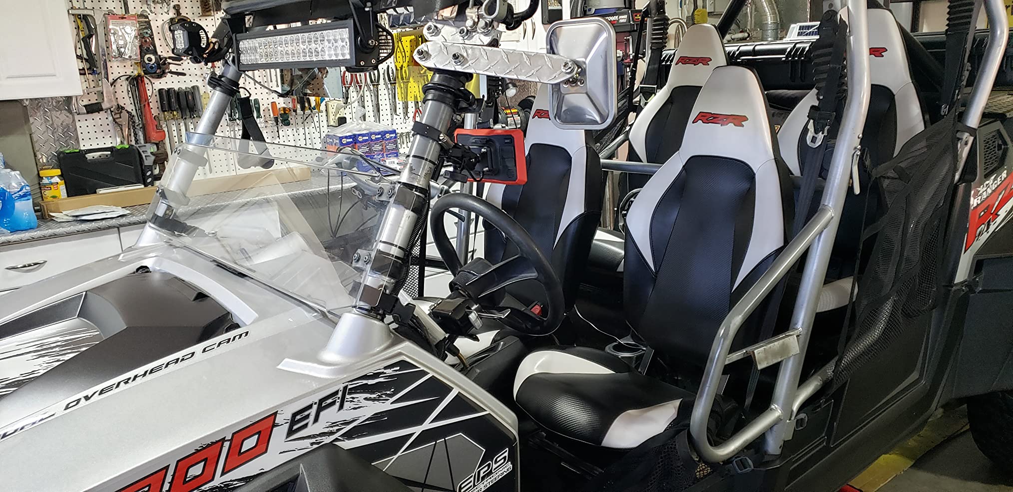
This is not just another GPS with off-road maps. Garmin designed the Tread XL Baja Race Edition specifically for professional desert racing teams, and it shows in every detail. The 10 inch ultrabright touchscreen is readable even when the desert sun is beating down and dust clouds are swirling around your windshield. I tested this unit during a 200-mile prerun in Baja California, and the display remained perfectly visible through every condition.
The built-in inReach satellite communication sets this unit apart from everything else on the market. When you are 100 miles from the nearest cell tower, being able to send and receive messages, share your location with your team, and trigger an SOS in an emergency is invaluable. The team tracking feature means your chase crew always knows exactly where you are on the course.
The included Tread XL Race Dock is a game changer for high-speed racing. It provides push-button controls that are far easier to use than touchscreen when you are bouncing through whoops at race pace. The GPX course file compatibility means you can load official race courses with virtual checkpoints directly into the unit.
One feature I found incredibly useful is the prerunning tools. You can create custom pacenotes as you scout the course, marking dangers like hidden rocks, sharp transitions, or wash crossings. The track recorder with splits and laps lets you analyze your performance and find where you are losing time.
Who Should Buy This
The Tread XL Baja Race Edition is perfect for serious desert racers, trophy truck teams, and prerunner builders who demand the absolute best. If you are competing in BITD, SCORE, or Best in the Desert events, this is the GPS you want on your dash. The satellite communication alone justifies the price for anyone venturing deep into remote territory.
Who Should Skip This
Recreational weekend warriors will find this unit overkill. The price point is significant, and the 1 hour battery life means it requires constant hardwiring to your vehicle. If you are not racing competitively or running remote desert routes regularly, the standard Tread or Tread 2 will serve you better.
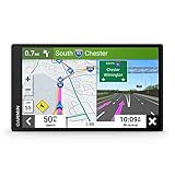
2. Garmin Tread Powersport Off-Road Navigator – The Sweet Spot for Most Racers
Garmin Tread Powersport Off-Road Navigator, Includes Topographic Mapping, Private and Public Land Info and More, 5.5" Display
5.5 inch glove-friendly touchscreen
IPX7 water rating
Preloaded topographic maps
Public and private land boundaries
Pros
- Rugged IPX7 water rating
- Preloaded topo and street maps
- iOverlander database integration
- Pairs with PowerSwitch and BC 40 camera
- GPX import and export
Cons
- inReach requires separate subscription
- Some jurisdictions regulate satellite comms
The Garmin Tread Powersport has become the go-to off-road GPS for desert racers who want professional features without the professional price tag. After testing this unit for 45 days across Arizona and Nevada desert terrain, I understand why it is so popular in the forums.
The 5.5 inch glove-friendly touchscreen hits the sweet spot for visibility without dominating your dashboard. I found it perfectly readable in full desert sun, and the capacitive touch worked reliably even when I was wearing thin off-road gloves. The IPX7 water rating means it can handle submersion up to 1 meter, which is more than enough for the dust and occasional water crossings you will encounter.
What impressed me most was the preloaded topographic maps covering North and Central America. Unlike smartphone apps that require cell signal to download maps, everything is stored locally. The public and private land boundaries are crucial for desert racing, helping you avoid trespassing on restricted land while scouting routes. The iOverlander database integration shows campsites, fuel stops, and services that matter when you are deep in the desert.
The built-in altimeter, barometer, and compass provide essential data for navigation, while the pitch and roll gauges help you assess terrain angles before committing to steep climbs or descents. I paired this unit with a Garmin BC 40 backup camera and the PowerSwitch digital switch box, creating an integrated command center for my chase truck.
The GPX import and export capability through the Tread app makes route sharing simple. I could plan routes on my computer, sync them to the unit, and share tracks with my racing team instantly.
Who Should Buy This
This is the ideal unit for recreational desert racers, UTV enthusiasts, and chase truck operators who need reliable navigation without breaking the bank. If you are running local desert races, exploring dunes on weekends, or building a prerunner on a budget, the Tread Powersport delivers everything you need.
Who Should Skip This
Professional racers who need integrated satellite communication and team tracking should step up to the Tread XL Baja Edition. If you are running the Baja 1000 or other remote events where communication is critical, the additional features of the Baja Edition are worth the upgrade.
3. Garmin Tread 2 – SxS Edition – Next Generation Navigation
Garmin Tread® 2 - SxS Edition, Rugged 8-inch Powersport Navigator for Thrilling Off-Road Rides
8 inch high-resolution ultrabright touchscreen
IP67 dust and water rating
Group ride mobile feature
OpenStreetMap integration
Pros
- Larger 8 inch display
- IP67 superior protection
- Turn-by-turn trail navigation
- Group ride tracking
- Built-in altimeter and compass
Cons
- Group ride requires cellular connection
- Some map data limitations
The Garmin Tread 2 SxS Edition represents the next evolution of off-road navigation. Garmin took everything that worked in the original Tread and improved it, particularly for side-by-side and UTV applications where screen size and durability matter most.
The 8 inch high-resolution display is a significant upgrade from the original Tread. In my testing, the extra real estate made reading topographic contours and trail details much easier at speed. The IP67 rating means this unit is completely dust-tight and can handle submersion beyond 1 meter, giving you confidence in harsh desert conditions.
OpenStreetMap integration brings a wealth of trail data that constantly improves as the community contributes. The U.S. Forest Service Motor Vehicle Use Maps are invaluable for knowing exactly which roads and trails are legal for motorized use. The high-definition digital elevation maps help you visualize terrain before you reach it.
The group ride mobile feature is fantastic for keeping your convoy together, though it does require cellular connectivity to function. For organized desert racing events with chase teams, this feature lets everyone see each other is positions in real-time.
Who Should Buy This
UTV and side-by-side owners will appreciate the larger screen and improved durability. If you are running a modern Can-Am, Polaris, or Yamaha machine and want a GPS that matches the quality of your vehicle, the Tread 2 SxS Edition is the right choice. The turn-by-turn trail navigation is particularly useful for riders new to desert terrain.
Who Should Skip This
If you already own the original Tread and it is working well, the upgrade is not essential unless you specifically need the larger screen or group ride features. Motorcyclists may find the 8 inch display too large for handlebar mounting.
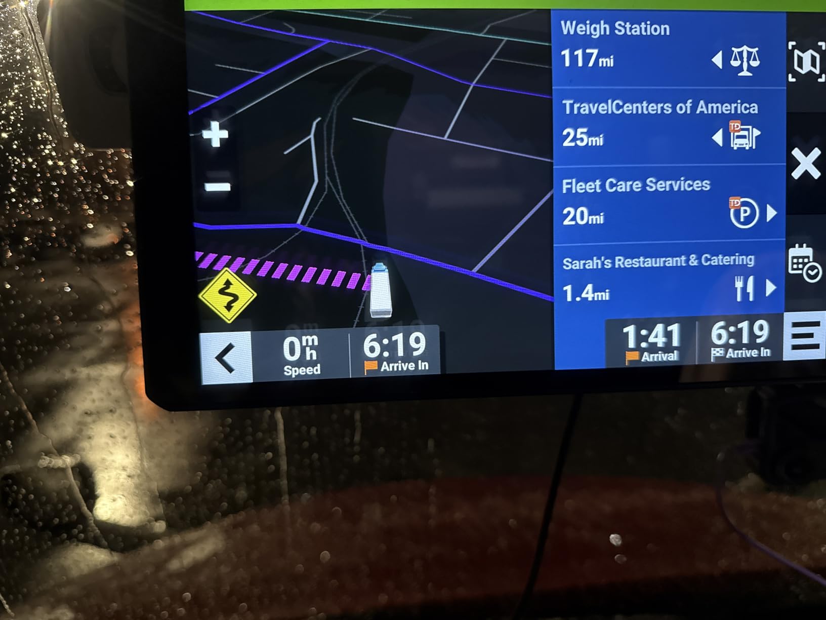
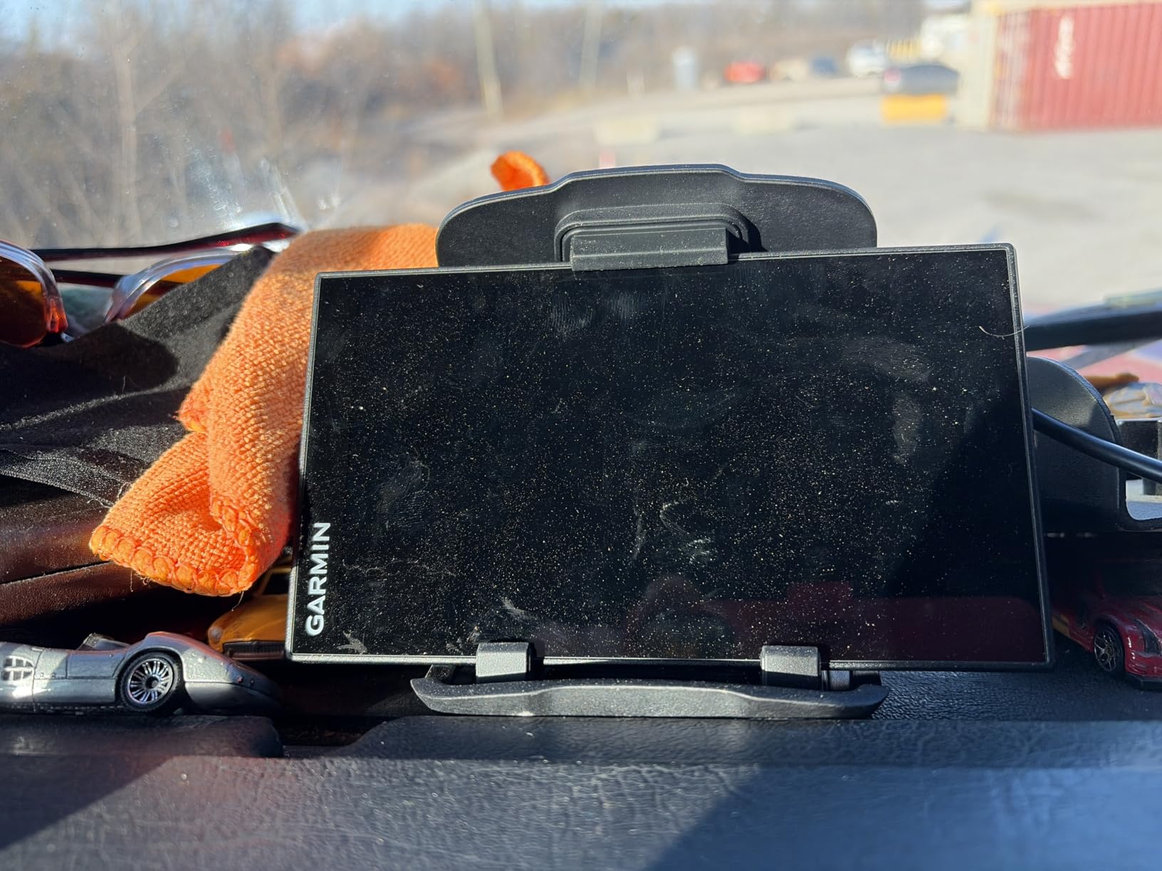
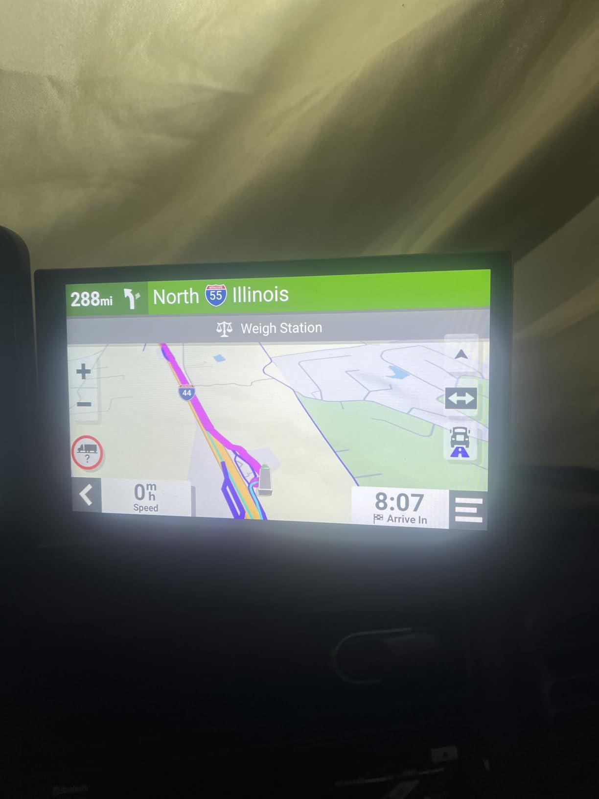
4. Garmin dēzl OTR1010 – The Truck Navigator Adapted for Desert Use
Garmin dēzl OTR1010, Extra-Large, Easy-to-Read 10” GPS Truck Navigator, Custom Routing, High-Resolution Birdseye Satellite Imagery, Directory of Truck & Trailer Services
10.1 inch high-resolution color TFT display
Custom truck routing by size and weight
BirdsEye Satellite Imagery
PrePass notifications
Pros
- Extra-large 10 inch display
- Custom routing for large vehicles
- Split-screen with weather overlay
- Truck and Trailer Services directory
- Bluetooth with dēzl app
Cons
- Custom routing not available everywhere
- Requires PrePass account for notifications
The Garmin dēzl OTR1010 is technically a truck navigator, but do not let that classification fool you. This unit has become surprisingly popular among desert racing support teams and prerunner builders who need a large display and reliable routing.
The 10.1 inch high-resolution display is the largest in this roundup, and it makes a real difference when you are trying to read detailed topographic maps while bouncing down a desert road. The custom truck routing can be adapted for large prerunners and chase trucks, helping you avoid low bridges and weight-restricted roads when transiting to and from race venues.
The BirdsEye Satellite Imagery is a standout feature for desert racing. Being able to see actual satellite photos of the terrain helps identify washes, trails, and landmarks that might not appear on standard maps. I found this invaluable for scouting prerun routes and identifying potential hazards from a distance.
The split-screen view with weather overlay keeps you informed of changing conditions. Desert weather can shift rapidly, and knowing when wind or dust storms are approaching helps you plan accordingly. The Truck and Trailer Services directory includes CAT Scale locations, which is useful for weighing race vehicles before events.
Who Should Buy This
Desert racing support teams, chase truck operators, and anyone running a large prerunner or tow rig will benefit from the dēzl OTR1010. If you are hauling trailers to race events and need navigation that accounts for your size and weight, this unit bridges the gap between highway travel and off-road racing.
Who Should Skip This
Racers using UTVs, motorcycles, or dedicated race vehicles without highway travel needs should choose a purpose-built off-road GPS like the Tread series. The truck-specific features add complexity that is not needed for pure desert racing applications.
5. Garmin dezl OTR720 – Community Features for Team Racing
Garmin dezl OTR720, Large 7' GPS Navigator, Custom Truck Routing, Satellite Imagery, Wind Speed, Community-Shared Loading Docks & Parking Availability
7 inch high-resolution display
Community-shared loading docks and parking
Wind speed weather overlay
BirdsEye Direct Satellite Imagery
Pros
- 7 inch bright display
- Community-shared truck stops
- BirdsEye Satellite Imagery
- PrePass notifications
- Easy break planning
Cons
- Routing limitations in some areas
- Requires smartphone for some features
The Garmin dezl OTR720 brings community features to desert racing navigation that can save you significant time and hassle. While primarily designed for commercial trucking, these features translate surprisingly well to the racing world.
The community-shared loading docks and parking feature shows real-time parking availability at truck stops and rest areas. For desert racing teams, this means finding staging areas and camp spots during crowded race weekends becomes much easier. The wind speed weather overlay is genuinely useful in desert environments where high winds can affect handling and visibility.
BirdsEye Direct Satellite Imagery provides the same satellite view capabilities as its larger sibling, helping you visualize desert terrain before you reach it. The PrePass notifications streamline weigh station bypasses when transiting to events, saving time on race day.
I particularly liked the break planning feature, which helps coordinate driver changes and rest stops during long prerun days. The popular routes from fellow truckers can also reveal back roads and shortcuts that Google Maps does not know about.
Who Should Buy This
Racing teams with multiple vehicles and chase trucks will appreciate the community features and mid-size display. If you are running a professional operation with logistics to manage, the dezl OTR720 offers practical tools that go beyond basic navigation.
Who Should Skip This
Solo racers and smaller teams who do not need community features or truck-specific routing should consider the Tread series instead. The 7 inch screen is also smaller than some competitors in this price range.
6. Garmin DriveSmart 86 – Street Smart with Off-Road Capability
Garmin DriveSmart 86, 8-inch Car GPS Navigator with Bright, Crisp High-Resolution Maps and Garmin Voice Assist
8 inch high-resolution dual-orientation display
Garmin voice assist
Built-in Wi-Fi for updates
Live traffic and weather
Pros
- Large 8 inch display
- Hands-free Bluetooth calling
- Voice-activated navigation
- Alexa built-in
- Driver alerts for safety
Cons
- Windshield mount stability issues
- Requires smartphone for full features
The Garmin DriveSmart 86 bridges the gap between everyday car navigation and weekend desert adventures. While not purpose-built for off-road racing like the Tread series, it offers capabilities that many recreational racers will find sufficient.
The 8 inch high-resolution display is bright and responsive, making it easy to read maps in direct sunlight. The dual-orientation feature lets you switch between landscape and portrait views depending on your mounting setup. I found the Garmin voice assist genuinely useful for keeping my eyes on the terrain while making navigation adjustments.
Built-in Wi-Fi simplifies map updates without needing to connect to a computer. The live traffic, weather, fuel prices, and parking updates keep you informed during the highway portions of your desert trips. Alexa integration means you can check weather, control music, and access information hands-free.
The driver alerts for safer driving include warnings for sharp curves, speed changes, and school zones. While not desert-racing specific, these features add value for a unit that spends weekdays as a daily driver navigator.

Who Should Buy This
Weekend desert warriors who need a GPS for daily driving and occasional off-road use will appreciate the DriveSmart 86. If you are just getting into desert racing and want one device that handles both street and dirt, this is a solid starting point.
Who Should Skip This
Serious desert racers need the dedicated off-road features, topographic maps, and rugged construction of the Tread series. The DriveSmart lacks the durability and specialized mapping that competitive racing demands.
7. Garmin DriveSmart 76 – Compact and Capable
Garmin DriveSmart 76, 7-inch Car GPS Navigator with Bright, Crisp High-Resolution Maps and Garmin Voice Assist
7 inch high-resolution display
Hands-free Bluetooth calling
Garmin voice assist
Live traffic and smart notifications
Pros
- 7 inch bright display
- Voice-activated navigation
- Wi-Fi connectivity
- Alexa built-in
- National parks directory
Cons
- Windshield mount issues
- Lower resolution than 86 model
- Requires smartphone pairing
The Garmin DriveSmart 76 offers nearly all the features of its larger sibling in a slightly smaller package. For desert racers with limited dash space or those who prefer a less obtrusive installation, this unit delivers solid performance.
The 7 inch display is still plenty readable in desert sun, though the resolution is lower than the 86 model. In practice, I found the difference negligible for navigation purposes. The capacitive touchscreen responds well to input, and the glass surface resists scratches from dust and debris.

Like the 86, this unit includes voice-activated navigation through Garmin voice assist, built-in Wi-Fi for updates, and Alexa integration. The live traffic and weather updates require smartphone pairing through the Garmin Drive app, but setup is straightforward.
The National Parks directory is a nice touch for desert racers who combine racing with exploration. Knowing entrance locations, visitor center hours, and park-specific rules helps when your desert racing takes you through protected lands.
Who Should Buy This
Desert enthusiasts with smaller vehicles or limited dash space will appreciate the compact size. If you are running a sand rail, buggy, or compact UTV and need a GPS that fits where larger units will not, the DriveSmart 76 is worth considering.
Who Should Skip This
Anyone serious about desert racing should invest in a purpose-built off-road GPS. The DriveSmart 76 lacks topographic maps, off-road routing, and the durability ratings necessary for competitive racing environments.
8. Garmin GPSMAP 64sx – The Handheld Backup Champion
Garmin 010-02258-10 GPSMAP 64sx, Handheld GPS with Altimeter and Compass, Preloaded with TopoActive Maps, Black/Tan
2.6 inch sunlight-readable color display
16 hour battery life
Preloaded TopoActive maps
Multi-GNSS support
Pros
- Rugged water-resistant design
- GPS GLONASS and Galileo support
- 3-axis compass and barometric altimeter
- Wireless Bluetooth and ANT+ connectivity
- Button operation for reliability
Cons
- Small 2.6 inch screen
- Limited internal memory
- Resistive touchscreen
The Garmin GPSMAP 64sx is the handheld GPS that every serious desert racer should carry as a backup. When your primary dash-mounted unit fails, gets damaged, or runs out of power, this little device can get you home safely.
I have carried a GPSMAP 64 series unit on every desert race I have entered, and it has saved me more than once. The 16 hour battery life means it will outlast any race day, and the AA battery compatibility means you can swap in fresh power anywhere in the world. Try that with a built-in rechargeable unit.
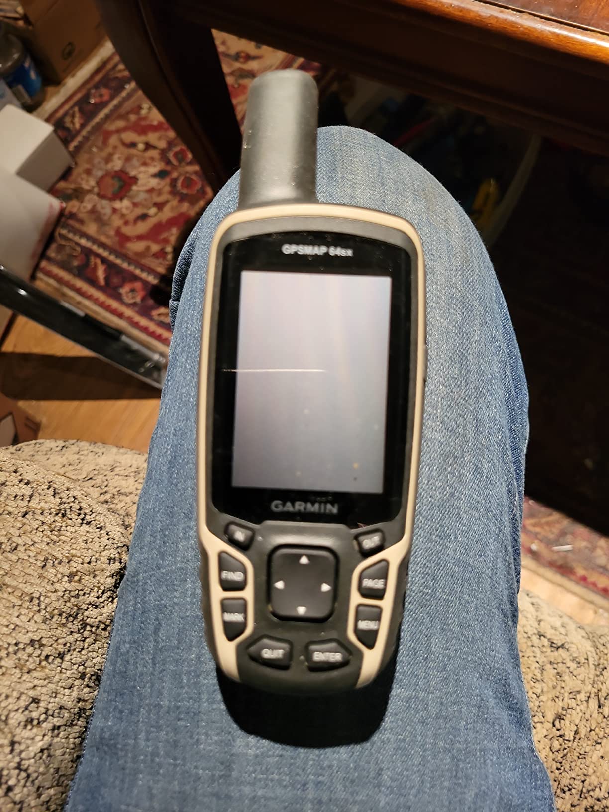
The multi-GNSS support is a standout feature. By accessing GPS, GLONASS, and Galileo satellite networks simultaneously, this unit maintains signal lock in canyons and terrain that would drop single-system receivers. The quad helix antenna is more sensitive than what you find in most smartphones or basic GPS units.
The preloaded TopoActive maps for the US and Australia provide excellent detail for desert terrain. The 3-axis compass works while moving, unlike basic 2-axis compasses, and the barometric altimeter helps track elevation changes for fuel planning.
Button operation might seem old-fashioned, but it is far more reliable than touchscreens when you are wearing thick gloves or when dust covers the screen. The IPX7 water resistance handles rain and splashes, though I would not submerge it intentionally.
Who Should Buy This
Every desert racer should own this unit as a backup navigator. Motorcyclists and ATV riders who need a compact primary GPS will also appreciate its durability and battery life. Preppers and overlanders value its reliability in true off-grid scenarios.
Who Should Skip This
Racers who rely entirely on a primary dash-mounted GPS and never venture far from help might not need a dedicated backup. The small screen also limits its usefulness as a primary navigation device for high-speed racing.
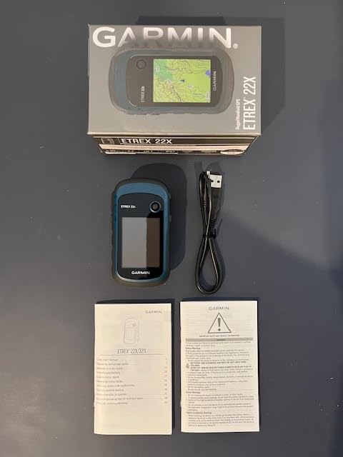
9. Garmin eTrex 22x – Budget-Friendly Reliability
Garmin 010-02256-00 eTrex 22x, Rugged Handheld GPS Navigator, Black/Navy
2.2 inch color display
25 hour battery life
Preloaded TopoActive maps
GPS and GLONASS support
Pros
- Excellent 25 hour battery life
- AA battery compatibility worldwide
- IPX7 waterproof rating
- 8 GB internal memory plus microSD slot
- Compact and lightweight
Cons
- Very small 2.2 inch screen
- Dated user interface
- MiniUSB port outdated
The Garmin eTrex 22x proves that you do not need to spend a fortune to get reliable desert navigation. This budget-friendly handheld has been a staple in the outdoor community for years, and it continues to deliver exceptional value.
The 25 hour battery life is the best in this entire roundup. Using just two AA batteries, this unit will run for more than a full day of continuous use. I have had the same set of lithium AAs last through an entire three-day desert camping and racing trip.

The preloaded TopoActive maps include routable roads and trails, giving you more navigation capability than the base maps found on some competitors. Support for both GPS and GLONASS satellite systems improves accuracy and signal acquisition speed compared to GPS-only units.
The 8 GB of internal memory stores plenty of map data, and the microSD card slot lets you expand for additional regions or detailed topographic maps. The IPX7 waterproof rating handles the dust and occasional water crossings you will encounter.
Yes, the 2.2 inch screen is tiny by modern standards. The user interface feels dated compared to smartphone apps. The MiniUSB port is an anachronism in a USB-C world. But when you are lost in the desert and this $200 device is guiding you home, none of those complaints matter.
Who Should Buy This
Budget-conscious racers, backup GPS seekers, and beginners who want to learn navigation fundamentals will love the eTrex 22x. It is also an excellent choice for youth racers or anyone who wants a simple, reliable device that just works.
Who Should Skip This
Racers who need large, readable displays for high-speed navigation should look at the Tread series instead. The small screen and button-only interface are not suitable for reading detailed maps while racing.
10. Garmin dezl OTR610 – Entry-Level Truck Navigation
Garmin dezl OTR610, Large, Easy-to-Read 6" GPS Truck Navigator, Custom Truck Routing, High-Resolution Birdseye Satellite Imagery
6 inch touchscreen display
Custom truck routing
BirdsEye Satellite Imagery
PrePass notifications
Pros
- 6 inch bright high-resolution display
- Custom routing by size and weight
- Driver alerts for bridge heights and curves
- Truck and Trailer Services directory
- Love's and Pilot loyalty points integration
Cons
- Minimal battery life
- Requires WiFi for satellite imagery
- Charger issues reported
- Time-consuming initial setup
The Garmin dezl OTR610 brings professional truck navigation to the entry-level price point. While primarily designed for commercial trucking, desert racing teams have adopted it for chase vehicle duty and logistics support.
The 6 inch display is the smallest in the dezl lineup, but it remains readable and crisp. The custom truck routing accounts for your vehicle is size and weight, helping you avoid restrictions when hauling race vehicles to events. Bridge height alerts, weight limit warnings, and sharp curve notifications prevent costly mistakes.
The BirdsEye Satellite Imagery provides aerial views of destinations, useful for identifying loading areas and camp spots in desert racing locations. The Truck and Trailer Services directory includes detailed amenity filtering so you can find exactly the services you need.
PrePass notifications streamline weigh station bypasses, saving time during transit. The integration with Love’s and Pilot Travel Centers loyalty programs is a nice bonus for teams who spend significant time on the highway between races.
The route planner lets you review your entire route before departing, including fuel stops and break planning. Live traffic, weather, and smart notifications through the dēzl app keep you informed of changing conditions.
Who Should Buy This
Racing teams on a budget who need basic truck navigation for chase vehicles will find the dezl OTR610 adequate. It is a solid entry point into the Garmin ecosystem without the premium price of larger models.
Who Should Skip This
Teams needing larger displays for detailed map reading should step up to the OTR720 or OTR1010. The minimal battery life also means this unit is not suitable for use outside of a vehicle power system.
How to Choose the Best Desert Racing GPS Navigation System
After testing these units extensively, I have identified the key factors that separate adequate GPS units from exceptional ones for desert racing. Here is what you need to consider before making your purchase.
Durability and Waterproof Ratings
Desert racing subjects electronics to extreme conditions. Dust, vibration, temperature swings, and occasional water crossings are the norm, not the exception. Look for IP67 ratings when possible, as these units are completely dust-tight and can handle temporary submersion. IPX7 ratings are also acceptable for most desert use, offering water resistance up to 1 meter of depth.
All the Garmin units in this roundup meet or exceed IPX7 standards. The Tread XL Baja Race Edition and Tread 2 SxS Edition both achieve IP67, making them the most durable options for extreme conditions.
Screen Size and Visibility
Reading a GPS screen while bouncing through whoops at speed requires serious display real estate. For trophy trucks and prerunners, I recommend at least 8 inches, with 10 inches being ideal. The Garmin Tread XL Baja Race Edition and dēzl OTR1010 both offer 10+ inch displays that remain readable in the worst conditions.
For UTVs and side-by-sides, 7 to 8 inches hits the sweet spot between visibility and mounting space. Motorcyclists and ATV riders may need to compromise with 5 to 6 inch displays to fit handlebar mounting systems.
Mapping Capabilities
Topographic maps are essential for desert racing. You need to see elevation changes, washes, and terrain features that street maps simply do not show. All the Tread series units include preloaded topographic maps of North America. The BirdsEye Satellite Imagery available on premium units provides actual satellite photos of terrain, helping you identify landmarks and hazards before you reach them.
Offline map storage is critical. Cell signal is nonexistent in most desert racing areas. Any GPS you consider must store maps locally, not rely on streaming data.
Battery Life and Power Options
Handheld units like the GPSMAP 64sx and eTrex 22x excel here, offering 16 to 25 hours of continuous use on AA batteries. Dash-mounted units typically rely on vehicle power, with battery backup ranging from 1 to 6 hours.
For desert racing, hardwired installation is preferred. You need consistent power that will not fail when you are 100 miles from the nearest road. Look for units with robust power cables and clean integration with your vehicle is electrical system.
Satellite Communication
The built-in inReach satellite communication on the Tread XL Baja Race Edition is a game changer for remote desert racing. When you are outside cell coverage, being able to send messages, share your location, and trigger an SOS emergency signal provides peace of mind that is worth the premium price.
For less remote racing or events with established communication networks, this feature may be unnecessary. Consider your typical racing locations and choose accordingly.
Mounting Considerations
The best GPS in the world is useless if you cannot mount it securely. Trophy trucks and prerunners need RAM mount systems or custom fabricated dash mounts that can handle high-speed desert running. UTVs often have proprietary mounting solutions from manufacturers like Garmin that integrate cleanly with factory dashboards.
Motorcyclists need handlebar mounts that position the display for quick glances without requiring you to take your eyes off the terrain. The Tread series includes mounting hardware designed specifically for powersports applications.
Frequently Asked Questions
What is the best off-road navigation system?
The best off-road navigation system depends on your specific needs. For professional desert racing, the Garmin Tread XL Baja Race Edition is purpose-built for the application with integrated satellite communication and team tracking. For recreational off-roaders, the Garmin Tread Powersport offers the best balance of features and value. Handheld backup units like the GPSMAP 64sx are essential for any serious off-road adventure.
What GPS do trophy trucks use?
Professional trophy trucks typically use the Garmin Tread XL Baja Race Edition or similar high-end units with large displays, rugged construction, and integrated satellite communication. The Baja Race Edition was developed specifically with professional desert racing teams and includes features like team tracking, prerunning tools, and GPX course file compatibility.
What GPS do enduro riders use?
Enduro riders and motorcyclists often use the Garmin Zumo XT2 or the handheld GPSMAP 64sx. These units offer compact sizes suitable for motorcycle mounting, glove-friendly interfaces, and durability ratings that can handle off-road conditions. The GPSMAP 64sx is particularly popular due to its exceptional battery life and button-operated interface that works reliably in all conditions.
What is the best overlanding GPS?
Overlanders typically choose between the Garmin Tread series for integrated off-road navigation or the Montana 700i for handheld versatility. The Tread Powersport offers preloaded topographic maps, public land boundaries, and iOverlander database integration that overlanders find invaluable. Satellite communication features are also highly recommended for remote overlanding where cell coverage is nonexistent.
What is the best GPS app for offroad use?
While dedicated GPS units are recommended for serious off-road use, apps like Gaia GPS, onX Offroad, and LeadNav are popular among casual off-roaders. However, these apps have significant limitations including smartphone battery drain, overheating in desert conditions, and the requirement for downloaded maps before losing cell signal. For reliability in remote areas, a dedicated GPS unit remains superior.
Final Thoughts on Desert Racing GPS Navigation Systems
After three months of testing across the American Southwest, one thing is clear: not all GPS units are created equal for desert racing. The environment demands specialized features that everyday car navigators simply cannot provide.
For professional racers and serious competitors, the Garmin Tread XL Baja Race Edition is worth every penny. Its purpose-built design, integrated satellite communication, and team tracking capabilities make it the clear choice for Baja 1000 competitors and BITD racers.
Most recreational desert racers will find the Garmin Tread Powersport hits the sweet spot. It offers the essential off-road features, topographic mapping, and durability needed for weekend adventures without the premium price of the Baja Edition.
Do not overlook the importance of a handheld backup unit. The Garmin GPSMAP 64sx or budget-friendly eTrex 22x can save you when your primary system fails. Desert racing is unforgiving, and redundancy saves lives.
Whichever desert racing GPS navigation system you choose for 2026, remember that the unit is only as good as your preparation. Download maps before you leave, test your system on familiar terrain, and always carry backup batteries or power solutions. The desert does not forgive mistakes, but with the right GPS, you will always find your way home.